When I was a kid, if I wanted my parents to drive me to a friend’s house, I had to hope that either they knew where the address was or print out a MapQuest map to guide them. It was a very different time!
Now, you just pull up the address in Google or Apple Maps or a standalone GPS unit and let your phone or device take you there. But how does it work? How does the phone or GPS receiver know where you are? How can this be used for a sci-fi setting?
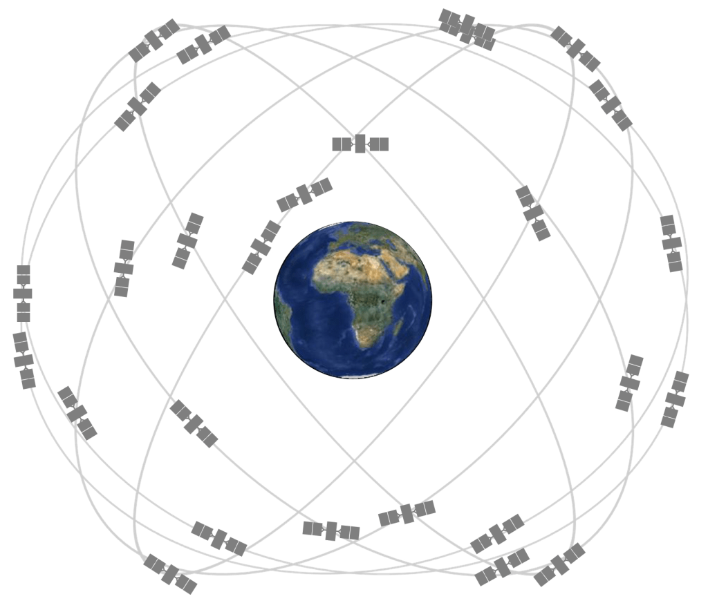
GPS Constellation
I’ll focus on the (formerly Navstar) Global Positioning System constellation for this explanation, but the EU Galileo/Russian Glonass/Chinese Beidou all work the same way.
I won’t go into the history of GPS – the Wikipedia page captures it pretty well. Currently there are 31 satellites orbiting the Earth in six orbital planes, with a non-public number of on-orbit spares which are decommissioned, older models. Each one of those spacecraft is continually broadcasting an L-band radio signal on two different frequencies (L1 and L2).
A GPS receiver needs to be in view of four of those satellites in order to be able to calculate where it is on the Earth. Why? Math of course!
GPS Calculations
If you remember back to middle school or high school math, if you have a series of linear equations with x number of variables, you need at least x equations in order to solve it.
GPS works just like that!
There are four unknowns, your position’s coordinates in an x,y,z reference frame and the difference in time between the GPS receiver’s clock and the clock on the satellite.

From each GPS satellite, the receiver gets an A, B, and C (its position in x,y,z) and d, the time differential between the satellite’s clock and the receiver clock.
Four equations, four unknowns, a lot of ways to solve it! The easiest way is a multivariate Newton method but you can do it analytically and substitute equation-by-equation until you have all 4 answers. Your receiver more than likely uses least-squares estimation to quickly generate a solution from the available data. If you are in view of more than 4 satellites, it can do it more easily and with greater accuracy.
Your phone does the same thing in Google or Apple Maps, but with cell phone tower data instead of data from the GPS satellites.
PNT Implications for Sci-Fi Stories
Simply put, to make GPS or a GPS-like solution work, you need four independent data sources at your receiver. For Earth-based works, GPS is in MEO so the signals go down to the Earth’s surface and a little bit beyond GEO, but they don’t reach cislunar orbits (a critique I had on a novel I recently beta-read!). In fact, my company is working with others on both lunar and Martian solutions for precision navigation. They might not need a 32-satellite constellation, but it’ll require more than one or two.
Some interesting things I’ve came up with in stories that have yet to see the light of day are ultralight balloons providing navigation signals on Venus (cut from Lag Delay!) and a solar system-wide navigation network with dozens of satellites at different Lagrange points in a short story.
Or, you could get into quantum navigation which is a whole other thing entirely.
Thanks and I hope this was useful for someone writing guidance, navigation, and control (GNC) topics in their sci-fi story!

Leave a reply to The Space Force – Ryan M. Patrick Cancel reply